


May 6, 2025
Nipmuck Trail Parallel to Chaffeville Rd – Caution
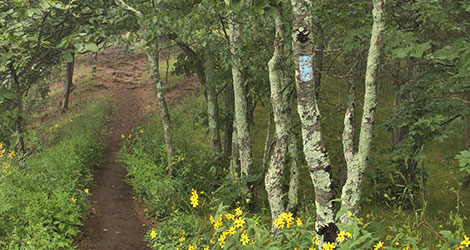
Nipmuck Trail
Notice
December 1, 2022
Trail flooded- Rt 44
Nipmuck Trail
Notice
September 28, 2021
Fenton River/ Iron Bridge- Trail Relocation
Nipmuck Trail
Relocation
Details
Trail Length: 40 miles
Towns: Ashford, Willington, Mansfield, Union
Allowed Uses: Hiking Only
Partners: Connecticut Department of Energy & Environmental Protection (DEEP), Joshua’s Trust, Friends of Mansfield Hollow, Yale University, Hull Forest Products, The Nature Conservancy
Trail Overview
The Nipmuck Trail extends from Mansfield north to the Massachusetts border. It is shaped roughly like an upside-down fork and has two southern branches: the West Branch starts on Puddin’ Lane in Mansfield; the East Branch starts in Mansfield Hollow State Park in North Windham. The northern terminus of the Nipmuck Trail is in the beautiful Bigelow Hollow State Park.
The trail crosses through a number of recreation and conservation areas including Mansfield Hollow State Park, the Natchaug and Nipmuck State Forests, Schoolhouse Brook Park, the Yale Forest, Bigelow Hollow State Park, and other lands owned by towns and land conservation trusts, most notably Joshua’s Trust. Highlights on the trail include Wolf Rock (an enormous glacial erratic), a lookout over Mansfield Hollow Lake, 50’ Cliff, Pixie Falls, Ladies Room Rock, Coye Hill (highest point on the Nipmuck Trail), and the Fenton and Mount Hope rivers. The Nipmuck Trail crosses the open field, follows along ridges and woods roads, and provides a continuous spine to which numerous other trail systems connect.
In Bigelow Hollow State Park, five additional trails (along with the Nipmuck Trail) are maintained by CFPA, totaling approximately 20 miles.
The trail passes through the Yale Myers Forest. For info on Mansfield Hollow State Park, click here. For info on Nipmuck State Forest & Bigelow Hollow State Park, click here.